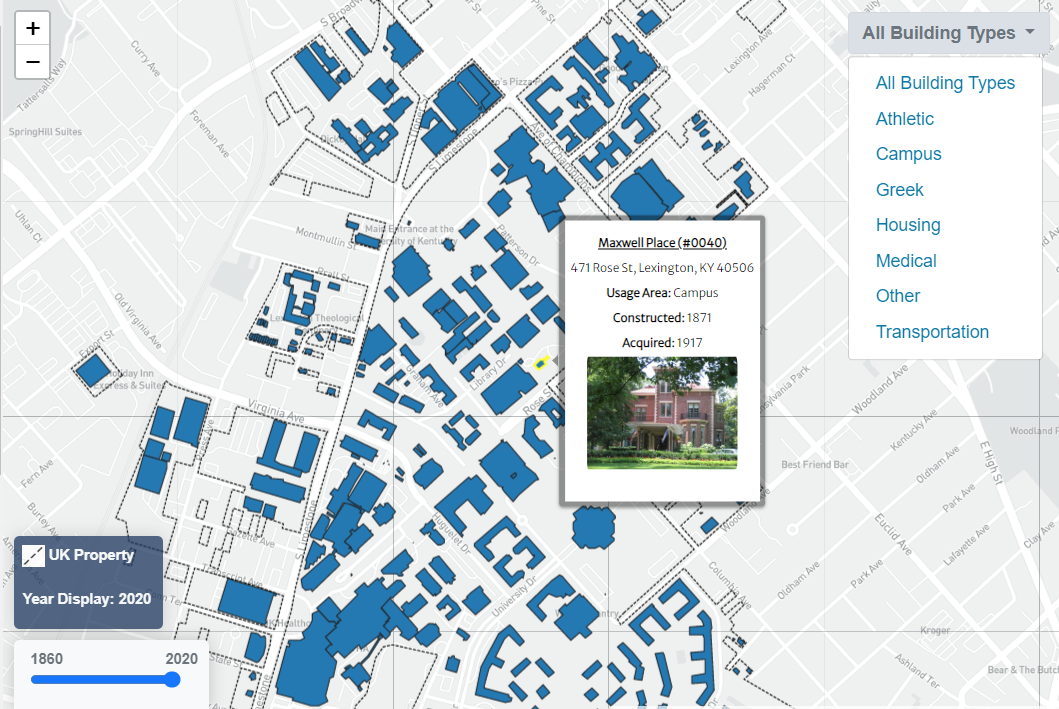
Experience the History and Expansion of UK Campus
The University of Kentucky campus is ever changing, it is interesting to see how the campus has grown since its founding in 1865. I hope this map engages users with the history of UK's campus and helps them gain a better understanding of how campus got to where it is today and where it may go in the future.
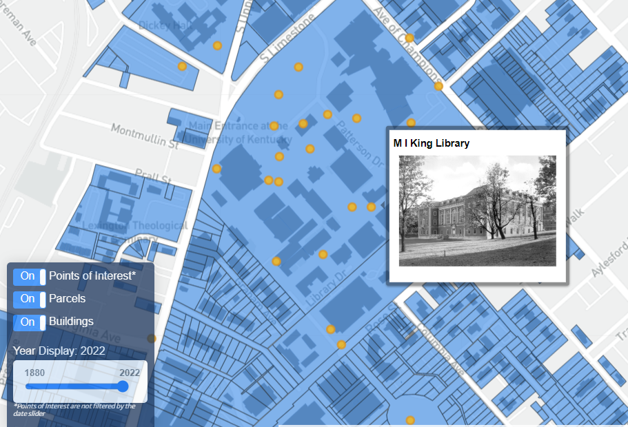
Campus Buildings through the Decades
Travel back through time and get a glimpse of the University of Kentucky (UK) campus. Use this map to explore building construction, acquisition, and historical trends in usage and campus planning.
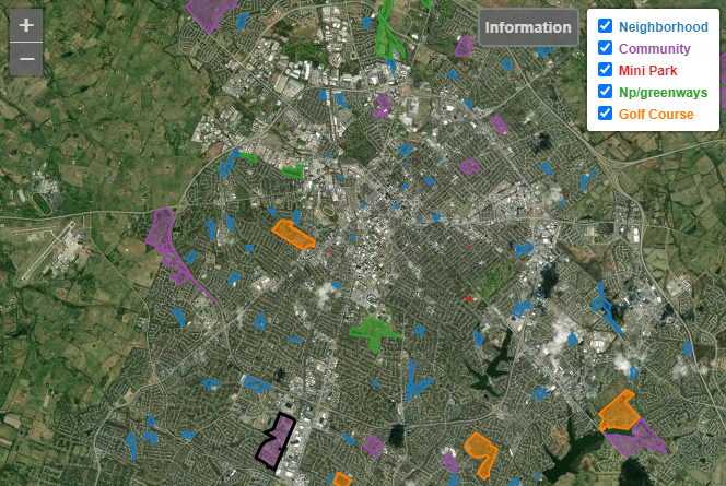
Lexington Parks
This mobile interactive map displays parks and recreation areas in Lexington, Kentucky. Features are symbolized by park type. When you hover over a feature, you will find the parks name, type, address and size.
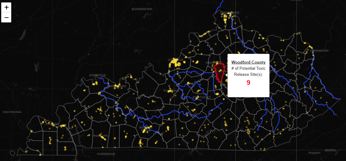
Kentucky Environmentally Hazardous Facilities
As a part of the Toxic Release Inventory (TRI) Program, the EPA collects annual reports from large facility sites around the United States. These reports contain information about the amount of toxic chemicals a facility has released into the environment. Use this interactive map to view the number of reported TRI sites within each Kentucky county.
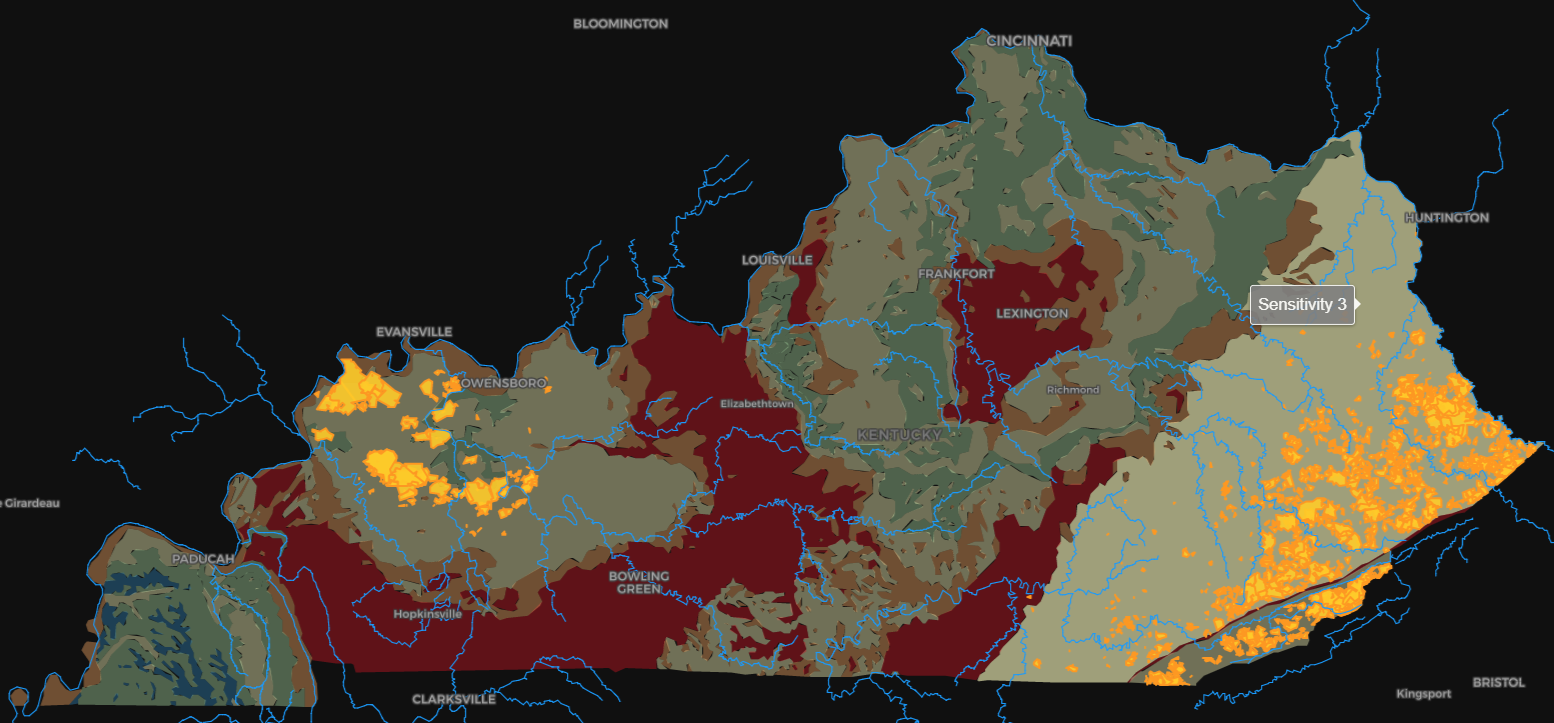
Kentucky Groundwater Sensitivity and Mining Activity
Groundwater is susceptible to contamination from activities on the land surface, and once contaminated can be hard to restore. Groundwater sensitivity is determined by the ease of contaminants moving in the system. Levels range from 1 (low) to 5 (high), and is only accounting for naturally occurring hydrology patterns - not human based activities such as mining. This map is comparing groundwater sensitivity regions to locations of active mines in Kentucky.
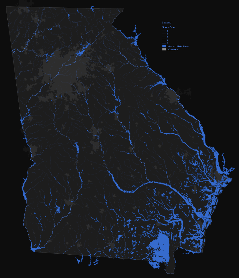
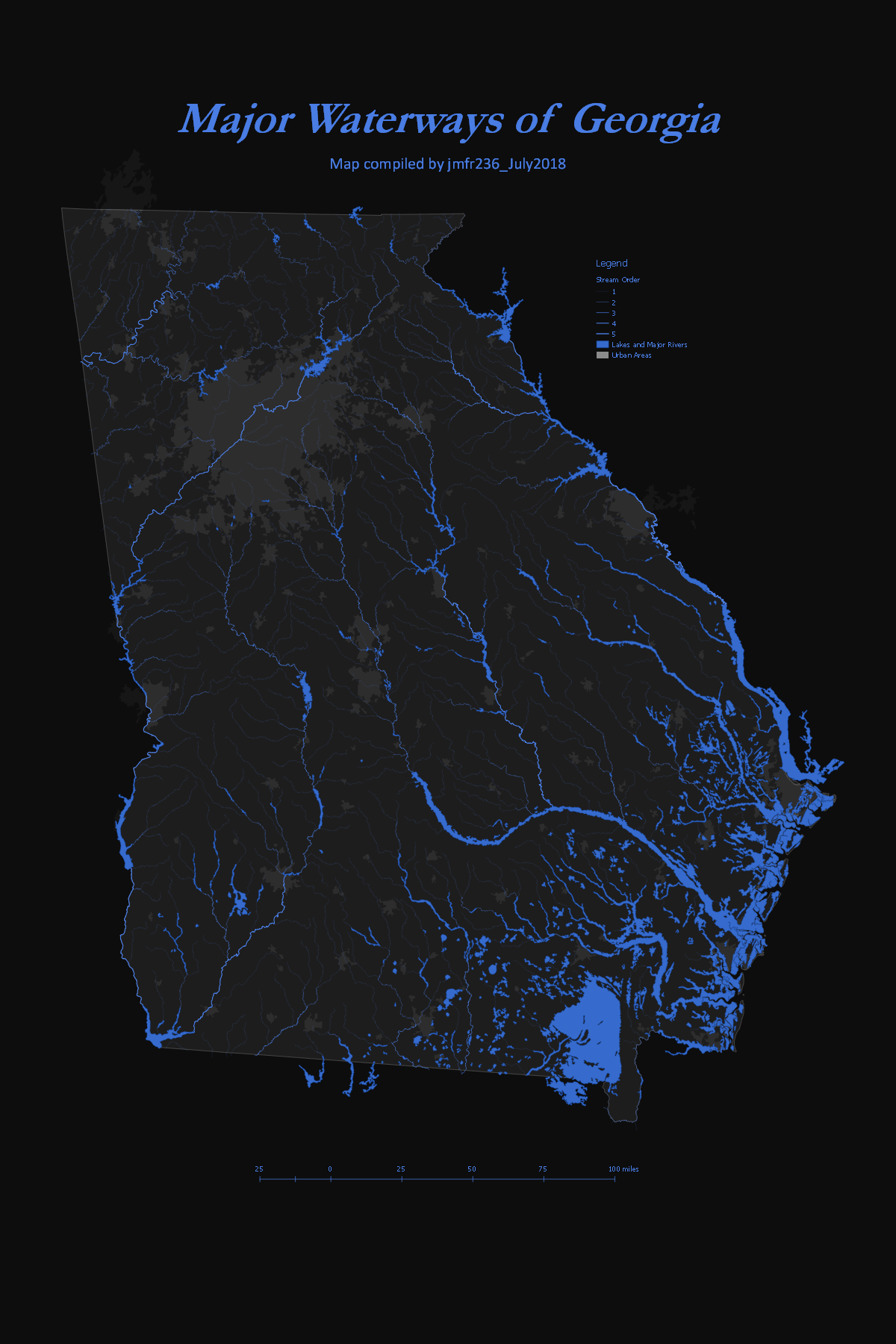
Major Waterways of Georgia
Static map embedded within a webpage. Map shows the major waterways and urban areas of Georgia.
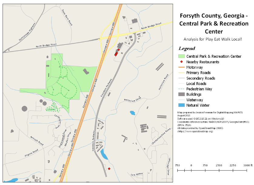
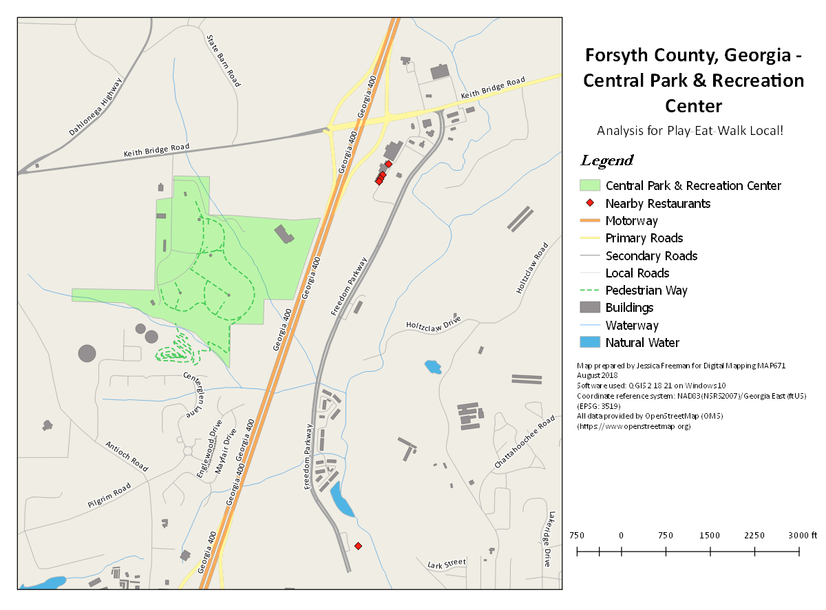
Play, Eat, Walk Local! Assessment Of Central Park in Forsyth County, Georgia
Examine restaurant proximity to Central Park & Recreation Center in Forsyth County. Static map is embedded within a webpage showing key features of the park and a breakdown of findings.
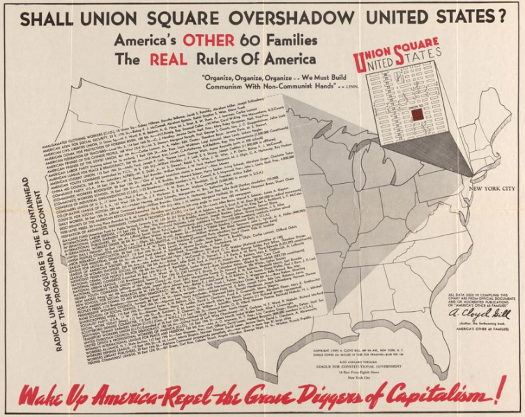
Persuasive vs Propaganda Maps
This presentation shows examples of persuasive and propaganda maps. Also discusses the key differences between the two methods. Presentation slides were created using leaflet template.